From Jetset magazine, January/February 2007
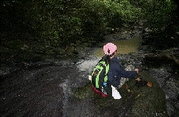
Six, four and two are the numbers to remember for Palaui Island. It stands for 642 , the distance of Manila to San Vicente, the last barangay in the northeastern portion of the island of Luzon. The numbers may be seen at the last km. marker near the fishport, which is the jump-off point to Palaui Island. It is fast becoming a tourist attraction in itself as visitors stop to have their pictures taken as proof that they have reached the tip of Luzon. They also stand for Six For Two, a special package designed for tourists who wish to know first hand what the island is all about. “Six activities for two days” provide a life changing experience as they explore the terrestrial and marine ecosystems, and learn about the history of the Century-old light house built by the Spaniards. Visitors who sign up for this program are taught how to snorkel on the reef and seagrass meadows, go through an interpretative hike along a primary forest, be part of a beach clean-up and learn about the issue on reef trash, plant mangroves, hike up the light house and learn about its history, and walk along the tidal pool areas.

A well kept secret
I first set foot on the island 15 years ago and it took a day to travel from Manila. Back then Palaui Island was one of those well kept secrets only seen by a few. Today, it is very accessible by land. The road network is very good and it is mere 2 ½ hours drive from Tuguegarao City, the capital of Cagayan province. A mere 1.2 mile of water separates this enchanting island from the mainland. In August 16, 1994, the entire 7,415 hectare island was declared a Marine Reserve under the category of Protected Landscape and Seascape. Palaui Island is part of the municipality of Sta. Ana and the Cagayan Freeport. The latter is being managed by the Cagayan Economic Zone Authority (CEZA). The island has been identified as a priority site for tourism development. As such a community-based sustainable tourism project was launched early this year by CEZA in partnership with the local government of Sta. Ana and the Department of Environmental and Natural Resources.
No major tourism effort has yet been made to promote the island, such that many residents of the province don’t even know of it. It has several natural ecosystems that are well preserved and can provide opportunities for outdoor activities. ”The island is the pride of Sta. Ana, hence the kind of tourism that we will implement will make sure that this paradise is protected and preserved.,” says Sta. Ana Mayor Norberto Victor Rodriguez.

Hotspot among hotspots
Because Barangay San Vicente, the jump-off point for Palaui Island may one day become a hub of economic activity. The landscape is fast undergoing a facelift as new buildings go up. Port Irene, built during the Marcos era is getting a refurbishing as a result in the increase in the number of businesses in the zone. Soon flights from Laoag or Tuguegarao may be landing at the airstrip over at the Naval Base and bring in the tourists. When this happens, Sta. Ana will become a major gateway in the north.
“Whether we like it or not, tourism will happen in this place. Uncontrolled tourism has devastating effects both to the culture of the people and the environment. Planning is essential to minimize the negative impacts and maximize the benefits for the economy and the environment, “ says CEZA Administrator Jose Mari Ponce.

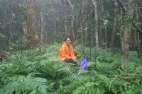
During a hike in the primary forest with Dr.Perry Ong, the chairman of the Institute of Biology of the University of the Philippines, I learned that the island harbors species which are yet to be identified. An inventory by Conservation International revealed at least two unidentified floral specimens. The islands biodiversity is very high. It may even be a hotspot among hotspots in the country since globally threatened and near -threatened species of birds, mammals and plants have been found here. The very colorful dwarf king fisher is a threatened species and scientists discovered it during an expedition last summer. It will not be surprising then if marine biologists also find unidentified specimens underwater. When American marine biologist Terence Gosslinger of the California Academy of Sciences saw a documentary about the island, he said that one of the nudibranchs (colorful marine snail without a shell) had not yet been named.
 Waterworld
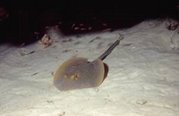
The saying, “The underwater terrain is an extension of the coastline” is very much true in Palaui Island. Just as cliffs and rock formations characterize the western coast, underwater are caves, tubes, tunnels and overhangs. The reefs over at this side of the island represents the best dive sites. Soft corals, crinoids, shells, stingrays, turtles and tropical fish in varied hues dominate the reefs. Whales and dolphins are often spotted from the boats and never fail to fascinate visitors.
During the rainy season this rugged portion of the island is riddled with at least 24 waterfalls. The scenery is surreal and enchanting specially to those who are not used to seeing waterfalls by the beach. Over at the northern tip is a light house built during the Spanish era. It stands on top of a hill and provides a magnificent view of Dos Hermanos Islands and the Babuyan Channel. Once I even saw wild carabaos and horses running across the grassland below, only to disappear into the forest as quickly as they have appeared.

Just as the northeast wind will soon be sweeping over the landscape of northeast Luzon, major changes in the lives of the people will soon be underway. Sta. Ana will become a hub not only for businesses but also for a special brand of tourism that focuses on outdoor education. If that happens, then the natural ecosystems of Palaui Island may well become one of the country’s better known natural sanctuaries , one that will teach people the value of resource protection and conservation.


No comments:
Post a Comment